Daily Update 2.7
Week 3: Module 2: Date 2/21/13
Now that we have learned a bit about the ships that the past explorers used let’s take a look at how these world travelers navigated. The first people who ventured out to sea stayed within sight of land. For many years this was the main strategy for not getting lost at sea. Another strategy that was widely used was a sounding or lead line. A sounding line was essentially a weight that could measure depth. It often had a cavity in the base in order to sample the ocean floor. This information combined with existing knowledge about the depths and the contents of the ocean floor along the route could help to locate a ship on that route.
The Phoenicians used the sun and stars to help navigate. It was often cloudless in the Mediterranean so this worked well for them. They developed a system involving quarters, what we call now call east and west. There are records of navigation by the little dipper around 600 BCE, but it is believed that celestial navigation went back much farther than that.
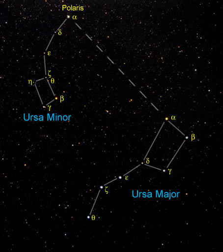
In the northern latitudes navigating by the stars became increasingly difficult in the summer months when the stars only appeared for a short time each day. The Vikings developed other means of navigating. One of these was relying on birds.

They would observe the birds, those flying with full beaks were heading back to their nests and those with empty beaks were headed out to sea. There is also a theory about a sunstone that the Vikings used. It was composed of a transparent calcite that would act as a polarizer and by looking through one you could find the sun on a cloudy day.
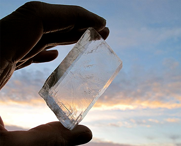
For more information on the Viking sunstone check out http://davidburchnavigation.blogspot.ca/2012/08/leif-karlsens-work-on-viking-sunstones.html.
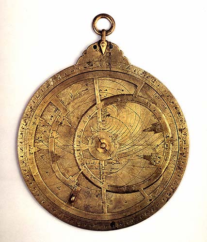
The astrolabe was a common navigational tool developed by the Greeks around 150 BCE. This tool could predict the location of the Sun, Moon, planets and the stars. In-depth information about astrolabes and how they work can be found here: http://www.astrolabes.org/. The Arabs refined the astrolabe and were using it to navigate all over the known world by the late 800’s.
What all of these early sailors and navigators had in common was their reliance on historical knowledge. These sailors relied on information passed down through the ages to sail across the open sea. As technology advanced people relied on it more and more. A trend that continues to this day! Tomorrow we will look at the navigational tools that brought navigation to the next level.
Sources and more information: http://kaloujm.com/page_kamal_uk.php http://www.astrolabes.org/ http://nabataea.net/sailing.html http://www.pbs.org/wgbh/nova/ancient/secrets-of-ancient-navigators.html http://www.ancient-wisdom.co.uk/navigation.htm http://www.ruf.rice.edu/~feegi/astro.html http://news.discovery.com/earth/navigating-by-sunstone-and-a-sixth-sense.htm http://www.starpath.com